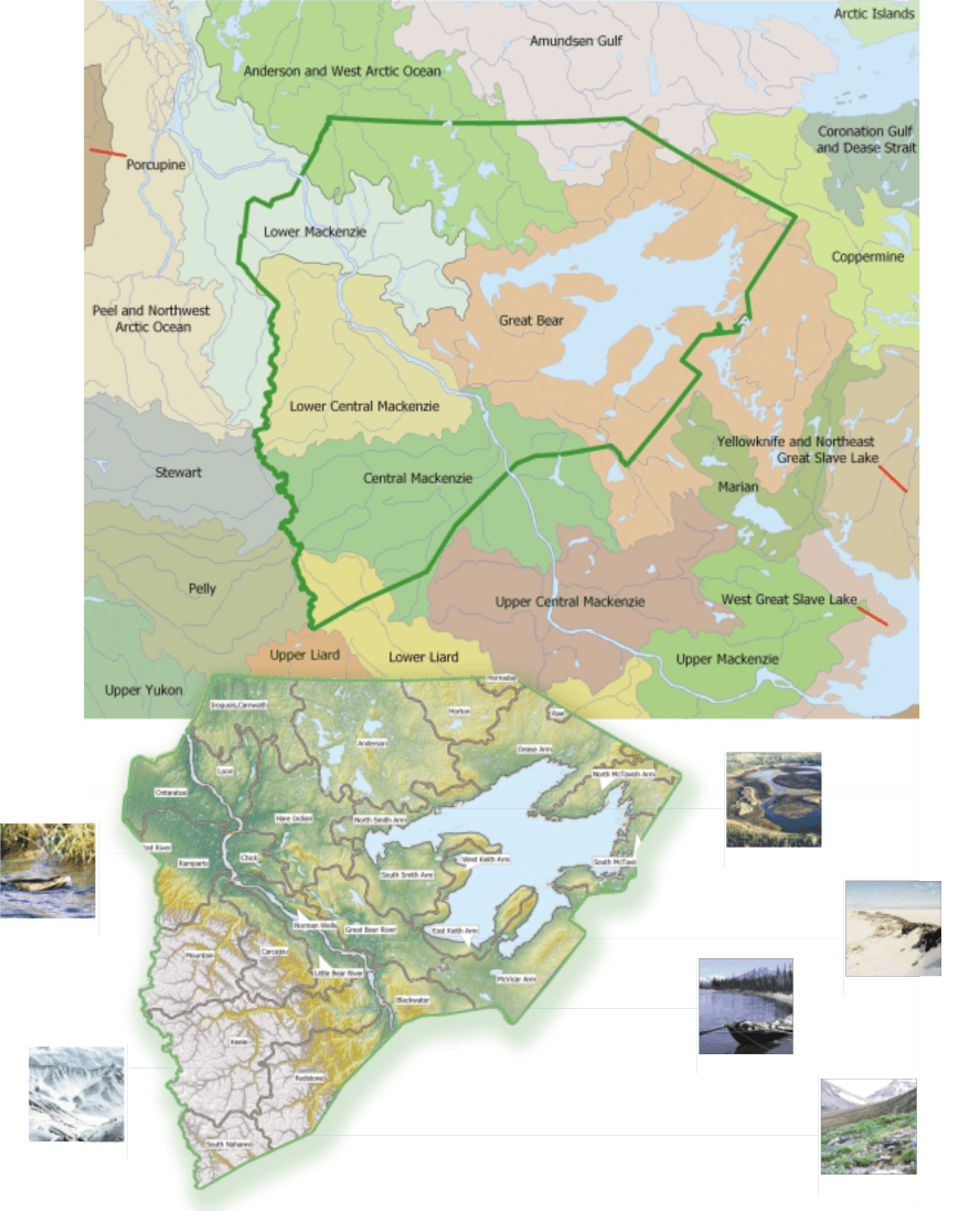
Ecoregions
Ecosystems, Ecozones and Ecoregions
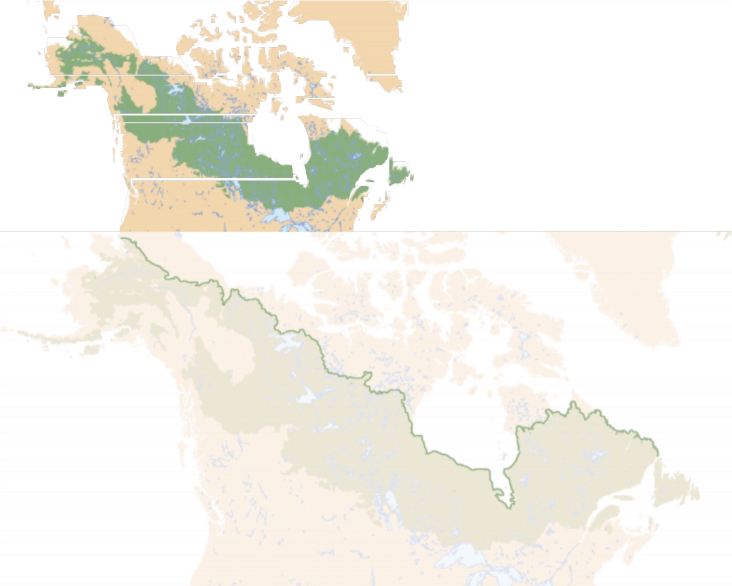
Canada is divided into 15 ecozones. At the top of the hierarchy, ecozone defines the ecological mozaic of Canada on a sub-continental scale. They represent an area of the earth's surface representative of large and very generalized ecological units characterized by interactive and adjusting abiotic and biotic factors.
ECOPROVINCE
A subdivision of an ecozone characterized by major assemblages of structural or surface forms, faunal realms, and vegetation, hydrology, soil, and macro climate. There are 53 ecoprovines in Canada
ECOREGION
A subdivision of an ecoprovince characterized by distinctive regional ecological factors, including climate, physiography, vegetation, soil, water, and fauna. There are 194 ecoregions in Canada The Sahtu has 15 ecoregions.
ECODISTRICT
Subdivision of an ecoregion is characterized by a distinctive assemblage of relief, landforms, geology, soil, vegetation, water bodies and fauna. Canada has 1021 ecodistricts.
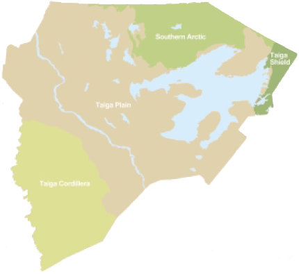
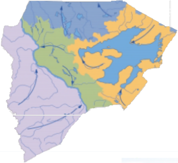
The Sahtu has four ecozones represented within its boundaries:
Southern Arctic - short cool summers; mean daily July temperature + 10° C; mean daily January temperature - 30° C; annual precipitation 250 to 500 mm
Taiga Plains - long cold winters; mean daily July temperature + 10 to 150 C; mean daily January temperature - 22.5 to -30° C; 250 to 500 mm precipitation
Taiga Sheild - short cool summers; mean daily july temperature + 7.5 to + 17.5; mean daily January temperature - 17.5 to -27.5; 250-500 mm annual precipitation
Taiga Cordillera - summers warm in south, short and cool in north; mean daily July temperatur + 12 to + 15° C; mean daily January temp. - 25 to - 30° C; 300-700 mm annual precipitation
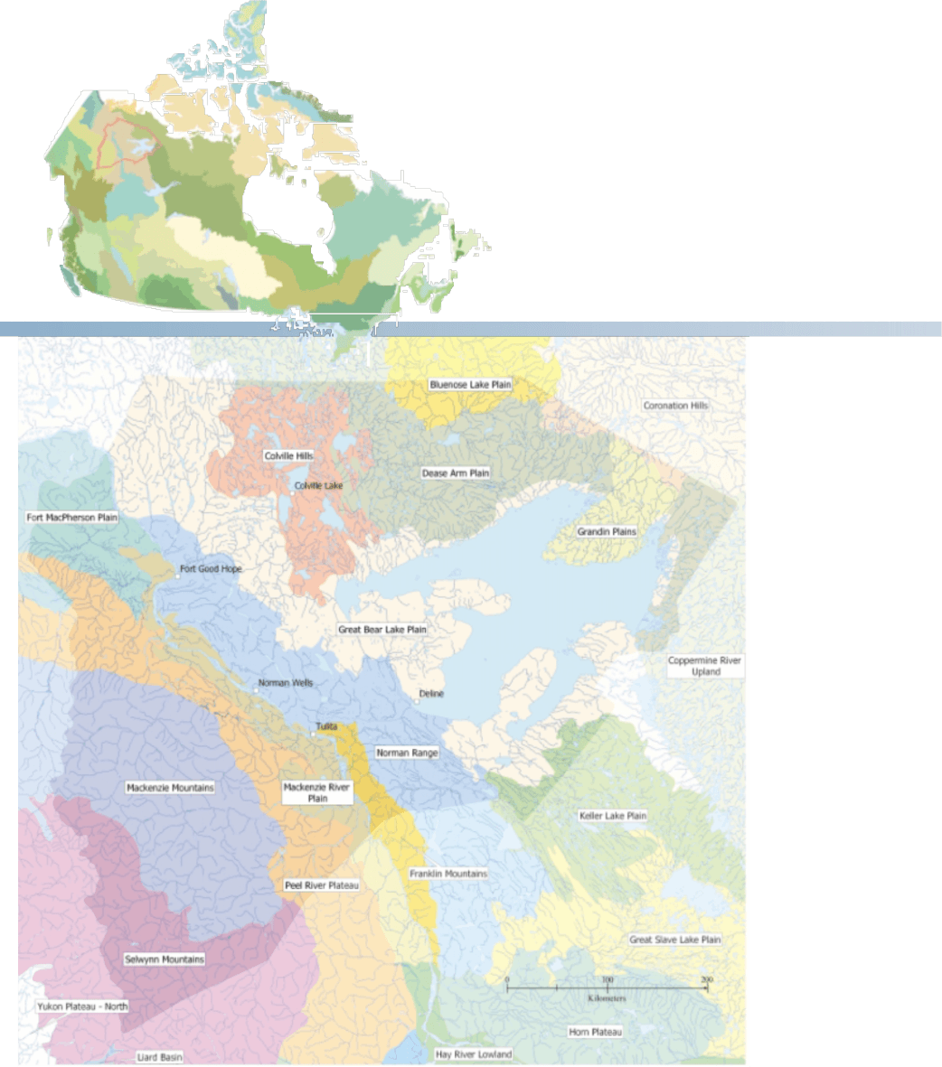
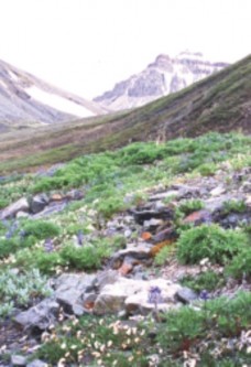
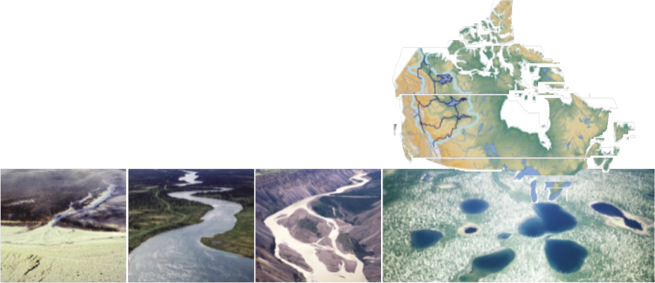
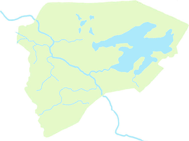
Ecoregions Of The Sahtu
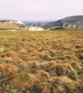
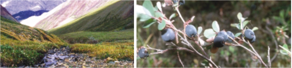
Dease Arm Plain
Located north of Great Bear Lake, Dease Arm Plain is classified as having a high subarctic ecoclimate. Tall shrub tundra, usually consisting of dwarf birch and willow, is the most common vegetative cover. The southern boundary of the ecoregion encompasses the area of tundra and subarctic forest transition, where open, very stunted stands of black spruce and tamarack with secondary quantities of white spruce and ground cover of dwarf birch, willow, ericaceous shrubs, cottongrass, lichen, and moss, are predominant. This ecoregion's rolling surface, which is generally below about 300 m elevation, is covered by glacial drift and outwash. A number of hills reach about 460 m. A wide range of Cryosolic soils, as well as Eutric and Dystric Brunisolic soils, have formed on hummocky to undulating, loamy glacial till. Organic landforms are usually high-centred lowland polygons.
Norman Range
The Norman Range lies between the Mackenzie River and Great Bear Lake Plains. This large region has a low subarctic ecoclimate. Vegetation is dominated by open stands of black spruce with an understory of dwarf birch, Labrador tea, lichen, and moss. Drier and warmer sites tend to have more white spruce, paper birch, and some aspen. Wet sites are usually covered with bog-fen vegetation such as dwarf black spruce, Labrador tea, ericaceous shrubs, and mosses. The Norman Range forms a series of north-south-trending, linear, relatively low ridges, largely of resistant Palaeozoic carbonates, and reaching elevations of about 1040 m asl. Great Bear Plain, composed of Cretaceous strata, has a rolling surface generally below 500 m asl. The surface of the ecoregion is covered with steeply sloping to undulating glacial drift, colluvium, and organic deposits in the form of polygonal peat plateaus. Turbic and Organic Cryosols, as well as Eutric Brunisols, are the dominant soils.
Franklin Mountains
The Franklin Mountain ecoregion and its low subarctic ecoclimate extends from Tulita down past Wrigly. The predominant vegetation is open stands of black spruce with an understory of dwarf birch, Labrador tea, lichen, and moss. Drier and warmer sites tend to have more white spruce, paper birch, and some aspen. Wet sites are usually covered with bog-fen vegetation such as dwarf black spruce, Labrador tea, ericaceous shrubs, and mosses. The Franklin Mountains form a series of linear, relatively low ranges and ridges, largely composed of resistant carbonates, that reach elevations of about 1525 m. This ecoregion's surface is covered with steeply sloping glacial drift, colluvium, and organic deposits in the form of polygonal peat plateaus. Turbic Cryosols, Eutric Brunisols, and Organic Cryosols are the dominant soils.
Colville Hills
Surrounding Colville Lake this ecoregion also has a high subarctic ecoclimate. The dominant vegetation is open, stunted stands of black spruce and tamarack with secondary quantities of white spruce, and a ground cover of dwarf birch, willow, ericaceous shrubs, cottongrass, lichen, and moss. Poorly drained sites usually support tussocks of sedge, cottongrass, and sphagnum moss. Low shrub tundra, consisting of dwarf birch and willow, is also common. The Colville Hills embrace several ridges of Palaeozoic carbonate strata that stand above the surrounding plains. The hills and ridges enclose basins which contain several large lakes in a netlike pattern with meshes of 15 km or more across. The lowlands lie at about 245–300 m above sea level (asl), whereas sinuous ridges reach elevations of 670 m. This hummocky to undulating plain is also characterized by extensive polygonal peat plateaus. Organic and Turbic Cryosols and Dystric Brunisols are the dominant soils in the ecoregion.
Fort Mcpherson Plain
Another ecoregion classified as having a high subarctic ecoclimate Fort Mcphereson Plain's predominant vegetation consists of open, very stunted stands of black spruce and tamarack with secondary quantities of white spruce. It has a ground cover of dwarf birch, willow, ericaceous shrubs, cottongrass, lichen, and moss. Like the Colville Hills the poorly drained sites usually support tussocks of sedge, cottongrass, and sphagnum moss and the low shrub tundra consists of dwarf birch and willow. Cretaceous shale lie below the surface, and incorporates a broad, shallow basin in its southwestern section at about 120 m asl. In the northeast, isolated hills rise to about 460 m, where it consists of Palaeozoic carbonate rocks. Both the Arctic Red and the Ontaratue rivers follow deeply incised valleys through to the Mackenzie River. Turbic and Organic Cryosols with some Static Cryosols developed on level to undulating morainal and organic deposits are the dominant soils. Unfrozen Dystric and Eutric Brunisolic soils also occur. Wetlands cover over 25% of the area in the north of the ecoregion, over 50% of the area in the south.
Grandin Plains
The Grandin Plains cover the entire area on the east side of Great Bear Lake known as ?ehdaîla (Caribou Point). The eoregion has a high subarctic ecoclimate. The latitudinal limits of tree growth are reached along its eastern boundary. The dominant vegetation is open, very stunted stands of black spruce and tamarack with secondary quantities of white spruce, and a ground cover of dwarf birch, willow, ericaceous shrubs, cottongrass, lichen, and moss. Low shrub tundra consists of dwarf birch and willow and poorly drained sites typically support tussocks of sedge, cottongrass, and sphagnum moss. Wetlands of peat plateau bogs, and ribbed and horizontal fens cover approximately 25% of the ecoregion. The Grandin Plain is covered by undulating glacial drift, raised beaches, and outwash deposits. Turbic Cryosols with Static and Organic Cryosols developed on loamy morainal and organic deposits are the dominant soils. Brunisolic soils have developed on unfrozen materials. The Grandin Plains also include a small portion of Great Bear Plain that is largely composed of Cretaceous shale.
Great Bear Lake Plain
This high subarctic ecoregion stretches across the widest section of the Sahtu and encopmasses the community of Deline. The latitudinal limits of tree growth are reached along its northern boundary. The predominant vegetation consists of open, very stunted stands of black spruce and tamarack with secondary quantities of white spruce and a ground cover of dwarf birch, willow, ericaceous shrubs, cottongrass, lichen, and moss. Like many of the Sahtu's ecoregions, the poorly drained sites support tussocks of sedge, cottongrass, and sphagnum moss and the low shrub tundra, consists of dwarf birch and willow. Composed of flat-lying Cretaceous shale and Devonian limestone strata, the surface of this ecoregion is generally below 310 m asl. As elevations gradually increase southward, entrenched river channels lie some 60–150 m below the surrounding surface. The ecoregion is generally covered by undulating glacial drift and outwash deposits. Turbic Cryosols with Static and Organic Cryosols developed on organic deposits with deep permafrost are the dominant soils. Unfrozen Organic and Brunisolic soils also occur.
Keller Lake Plain
Keller Lake Plain extends into a small portion of the region along the Sahtu's eastern edge. It is classified as having a low subarctic ecoclimate. The main vegetation is open stands of black spruce with an understory of dwarf birch, Labrador tea, lichen, and moss. Drier and warmer sites tend to have more white spruce, paper birch, and some aspen. Wet sites are usually covered with bog-fen vegetation such as dwarf black spruce, Labrador tea, ericaceous shrubs, and mosses. Wetlands cover over 25% of this ecoregion, which also includes the southeastern portion of Great Bear Plain and the northern section of Great Slave Plain. Composed of Cretaceous shale, its surface is generally below 310 m asl and is covered by undulating, peatcovered glacial drift and outwash deposits. Turbic and Organic Cryosols developed on organic and loamy morainal deposits are the dominant soils in the ecoregion.
Mackenzie River Plain
The Mackenzie River Plain is unique in the Sahtu with its subhumid high boreal ecoclimate. The ecoregion is a broad, rolling, drift-covered plain lying between the Mackenzie and Franklin mountains, into which the Mackenzie River is entrenched. Native vegetation consists predominantly of medium to tall, closed stands of black spruce and jack pine with an understory of feathermoss, bog cranberry, blueberry, Labrador tea, and lichens. White spruce, balsam fir, and trembling aspen occur in the warmer, more moist sites in the southern section of the region. Drier sites have more open stands of black spruce and jack pine. Low, closed and open stands of black spruce, ericaceous shrubs, and sphagnum mosses dominate poorly drained, peat-filled depressions. Wetlands cover 25–50% of the ecoregion, and are characteristically peat plateau bogs, and ribbed and horizontal fens. Dominant soils in the ecoregion are Organic and Turbic Cryosols and Eutric and Dystric Brunisols with some Regosols that have developed on terraced to rolling morainal, alluvial, lacustrine, and organic deposits.
Peel River Plateau
This high subarctic ecoregion is the plateau that rises above the Mackenzie River Plains to the Mackenzie Mountains. The predominant vegetation is open, very stunted stands of black spruce and tamarack with secondary quantities of white spruce, and a ground cover of dwarf birch, willow, ericaceous shrubs, cottongrass, lichen, and moss. Poorly drained sites usually support tussocks of sedge, cottongrass, and sphagnum moss. The low shrub tundra supports dwarf birch and willow. The surface of this ecoregion is characterized by truncated and upturned edges of Palaeozoic and Mesozoic strata, forming terraces, and rounded plateaus. Some portions of the ecoregion in the southwest are unglaciated, but most of its surface is covered by thin, discontinuous, hummocky to dissected glacial drift and organic deposits. Wetlands are present on over 25% of the ecoregion, characterized by peat plateau bogs, and ribbed and horizontal fens. Turbic and Organic Cryosols with some Eutric Brunisols and Static Cryosols are the dominant soils in the ecoregion.
Mackenzie Mountains
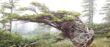
The Mackenzies show evidence of localized alpine and valley glaciation. The region is characterized by alpine tundra at upper elevations and subalpine open woodland vegetation at lower elevations. Alpine vegetation consists of lichens, mountain avens, intermediate to dwarf ericaceous shrubs, sedge, and cottongrass in wetter sites. Barren talus slopes are common. Subalpine vegetation consists of discontinuous open stands of stunted white spruce and occasional alpine fir in a matrix of willow, dwarf birch, and Labrador tea. The Ogilvie Mountains, composed of Palaeozoic and Proterozoic sedimentary strata intruded by granitic stocks, reach 2134 m asl in elevation. The Wernecke Mountains are formed of phyllite and nearly horizontal carbonate rocks carved by glaciation. They are divided into several ranges by broad northwesterly-trending valleys. Alluvium, fluvioglacial deposits, and morainal veneers and blankets are dominant in the region. Rock outcrops are common at higher elevation. Turbic Cryosols with some Dystric Brunisols and Regosols occur on steeply sloping colluvium.
Selwyn Mountains
For the most part this northern extension of the Rocky Mountains in the southern most tip of the Sahtu is a rugged mountain wilderness. The highest mountains found in the Northwest Territories occur in this ecoregion. The ecoregion is characterized by alpine tundra at upper elevations and by subalpine open woodland vegetation at lower elevations. Alpine vegetation consists of crustose lichens, mountain avens, dwarf willow, and ericaceous shrubs; sedge and cottongrass are associated with wetter sites. Barren talus slopes are common. Subalpine vegetation consists of discontinuous open stands of stunted white spruce, and occasional alpine fir and lodgepole pine, in a matrix of willow, dwarf birch, and northern Labrador tea with a ground cover of moss and lichen. Sedge, cottongrass, and mosses occur in wet sites. The Selwyn Mountains, which have been extensively glaciated, are composed of Palaeozoic and Proterozoic strata intruded by granitic stocks. They are divided into several ranges by broad, northwesterly- trending valleys. Some contain alpine and valley glaciers. Mount Keele, at 2950 m asl, is the most outstanding peak. Local alpine glaciers exist in the highest ranges of this ecoregion. Bare rock outcrops and rubble are common at higher elevation. Dystric and Eutric Brunisols on alluvial, fluvioglacial, and morainal veneers and blankets are dominant in the region. Static and Turbic Cryosols with Dystric Brunisols or Regosols are developed on upper-elevation, steeply-sloping colluvium.
Coppermine River Upland
The Coppermine River Upland the edges into the upper eastern area of the Sahtu is predominantly a high subarctic ecoclimate region. It is part of the tundra and boreal forest transition, where the latitudinal limits of tree growth are reached. The predominant vegetation consists of open, very stunted stands of black spruce and tamarack with secondary quantities of white spruce and a ground cover of dwarf birch, willow, ericaceous shrubs, cottongrass, lichen, and moss. Poorly drained sites typically support tussocks of sedge, cottongrass, and sphagnum moss. Low shrub tundra, consisting of dwarf birch and willow, is also common. This ecoregion includes the western half of the Bear-Slave Upland, which consists mainly of massive Archean rocks that form broad, sloping uplands, plateaus, and lowlands. The surface is typical of the bare rock parts of the Shield. Numerous lakes fill the lowlands, and rounded rocky hills reach 490 m asl in elevation. Bare rock outcrops are common, and Dystric Brunisols with some Turbic, Static, and Organic Cryosols are the dominant soils in the ecoregion. The soils have formed on discontinuous veneers and blankets of hummocky to rolling, sandy morainal, fluvioglacial, and organic deposits.
Bluenose Lake Plain
The Bluenose Lake Plain along the Sahtu’s north east edge has a low arctic ecoclimate. Shrub tundra vegetation forms a nearly continuous cover, consisting of dwarf birch, willow, northern Labrador tea, Dryas spp., and Vaccinium spp. Tall dwarf birch, willow, and alder occur on warm sites; wet sites are dominated by sphagnum moss and sedge. Much of the ecoregion is underlain by nearly flat-lying, Paleozoic carbonates and late Proterozoic sediments. The landscape surface reaches elevations of 365–610 m asl, the higher parts being in the south. The western portion of the region is rocky where exposed bedrock outcroppings are common. Eastern sections are covered by rolling to undulating glacial drift. With few exceptions, lakes are small and scattered. Streams gather size northward and become entrenched 60–120 m below the surface. Turbic Cryosols developed on rolling glacial moraine are the dominant soils, and are underlain by continuous permafrost with medium to high ice content in the form of ice wedges.
Coronation Hills
A thin edge of the Coronation Hills occupies the northeast section of the Sahtu. Like the Bluenose Lake Plains it is classified as having a low arctic ecoclimate. The nearly continuous cover of shrub tundra vegetation consists of dwarf birch, willow, northern Labrador tea, Dryas spp., and sedge tussocks. Tall dwarf birch, willow, and alder occur on warm sites; wet sites are dominated by willow and sedge. The southern boundary of the region has a mix of tundra vegetation and open, dwarf coniferous forest. The ecoregion is composed of large, rounded, low hills and lowlands consisting of Palaeozoic carbonates and stratified, down-faulted, and folded Proterozoic sediments. Surfaces range in elevation 200–600 m asl in Coronation Hills. Turbic and Static Cryosols developed on undulating to ridged glacial tills, fluvioglacial, and marine deposits are the dominant soils in the ecoregion. Organic Cryosols are associated with organic materials composing peat plateaus and high centre polygons.

[ Sahtu Atlas Table of Contents ]
[ Next Section ]
Boreal Biome and Treeline
There is evidence that the treeline once extended well north of Inuvik and the Arctic coast some 9000 years ago; it was of course pushed many hundreds of miles to the south, into what is now the central USA, by ice ages in the not so distant past.
Trees grow farther north through the Sahtu along the Mackenzie Valley up to the Mackenzie Delta almost to the shores of the Beaufort Sea, farther than anywhere else in Canada. The Mackenzie River and Valley create a micro-climate that is much friendlier to tree growth than other places at the same latitude.
It is a lack of summer warmth that sets a northern limit to tree growth. This explains why the treeline does not lie neatly along a parallel of latitude. It runs diagonally south-eastward from a point just north of Inuvik, to the southeast corner of the NWT.
The treeline is controlled by the following factors:
- Active Layer
- Altitude
- Aspect/Orientation
- Climate
- Latitude
- Permafrost
- Shelter
- Soils
- Water Availability
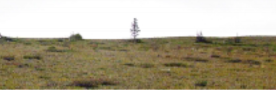
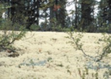
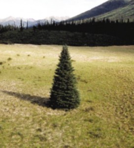
treeline
Where the permafrost is close to the surface, the active or seasonally thawed soils are too thin to accommodate roots. A tree's height is limited by the depth and holding power of the soil it is rooted in. Therefore, trees become shorter and smaller as the treeline is approached.
Boreal Biome
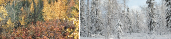
Much of the Sahtu is located in the boreal or “northern” forest – Canada's largest biome. The boreal biome occupies 35% of the total Canadian land area and 77% of Canada's total forest land, stretching between northern tundra and southern grassland and mixed hardwood trees. Named after Boreas, the Greek god of the North Wind, the boreal biome starts in the Yukon Territory, forming a band almost 1000 kilometres wide, and sweeps southeast towards Newfoundland. To its north is the treeline, and beyond that the tundra of the Arctic.
By far, the most dominant tree species are conifers, which are well-adapted to the harsh climate and thin, acidic soils. Black and White Spruce are characteristic species of this region along with Tamarack, Jack Pine and Balsam Fir. There are also deciduous trees, which are at times mixed in among the conifers, especially in more southern areas - they may include White Birch and Poplars. Over 200 bird species breed here, as well as being home to species such as Caribou, Lynx, Black Bear, Moose, Coyote, Timber Wolf and recovering populations of Wood Bison.
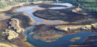
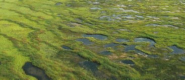
Also characteristic of the boreal biome are innumerable water bodies: bogs, fens, marshes, shallow lakes, rivers and wetlands, mixed in among the forest, and holding a vast amount of water. The winters are long and severe while summers are short, though often warm.
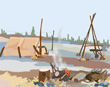
While direct economic forest resouces in the Sahtu such as logging are limited by infrastructure, population and tree size, the forests play a key role in supporting activites that remain esseantial parts of life in the Sahtu. Wood is still used by many for home heating and cabin construction. The Boreal forest also provides the habitat for wildlife which Dene and non-Dene rely on for food and income.
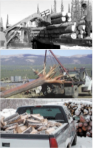
Deline log building project- top
Harvesting logs from the Mackenzie River - middle
Collecting winter fire wood supply - above
[ Sahtu Atlas Table of Contents ]
[ Next Section ]


 Phone: 867-374-4040
 Email: