The Sahtu Atlas Copyright and Cataloguing Information
All rights reserved. No part of this publication can be reproduced, stored in a retrievable system or transmitted in any format or by any means without prior written permission of the publisher, or in Canada in the case of photocopying or other reprographic copying a license from the Canadian Copyright Licensing Agency (CANOPY).
Printed in Canada
Library and Archives Canada Cataloguing in Publication
The Sahtu atlas / edited by James Auld, and Robert Kershaw ; compiled by Robert Kershaw ... [et al.].
ISBN 0-9737630-0-0
1. Sahtu Settlement Area (N.W.T.)--Maps. 2. Bearlake Indians--Land tenure--Northwest Territories--Sahtu Settlement Area- -Maps. I. Auld, James II. Kershaw, Robert III. Sahtu GIS Project.
G1183.S24S1 2005 912.719'3 C2005-901290-0
The Sahtu GIS Project acknowledges the financial support of the Department of Resources, Wildlife and Economic Development, Northwest Territories; Sahtu Renewable Resources Board and the Sahtu Land Use Planning Board.
Second Printing: September, 2005
Printed and bound in Canada by Friesens
Project Manager: James Auld, Sahtu GIS Project
Cartographer: James Auld
Designer: Robert Kershaw, Breaking Ground Communications Inc.
Managing Editor: Robert Kershaw
Assistant Editor/Researcher: Melonie Dyck
Assistant Editor/Researcher/Writer: Deborah Simmons
Project and Editorial Advisors: Miki Promislow, Alasdaire Vietch, Jody Snortland
Copy Editors - Andrea Paulos, David McNeill
Maps created by Sahtu GIS Project except Settlement Lands map obtained from DIAND, Legal Surveys Div.,NWT, 2000 Photographs from RWED archive and Robert Kershaw unless noted.
Stories from the following sources are reprinted by permission of the publishers:
Rakekée Gok’é Godi/Places We Take Care Of: Report of the Sahtu Places and Sites Joint Working Group.
Yellowknife, NT: Prince of Wales Northern Heritage Centre, 2000.
Building A Vision for the Land: Report on Community Interviews. Fort Good Hope, NT: Sahtu Land Use Planning Board, 1999.
Sahtú Godé Dáhk’é/Sahtu Place of Stories. Norman Wells, NT: Mackenzie Valley Viewer, Sept 2000 Oct. 2002, Vol. 192-217
[ Sahtu Atlas Table of Contents ]
[ Next Section ]
Introduction
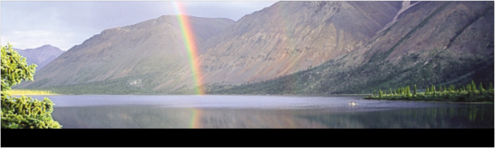
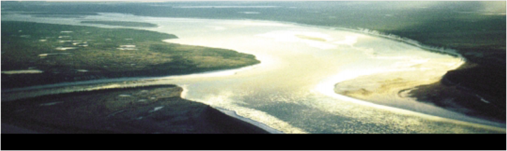
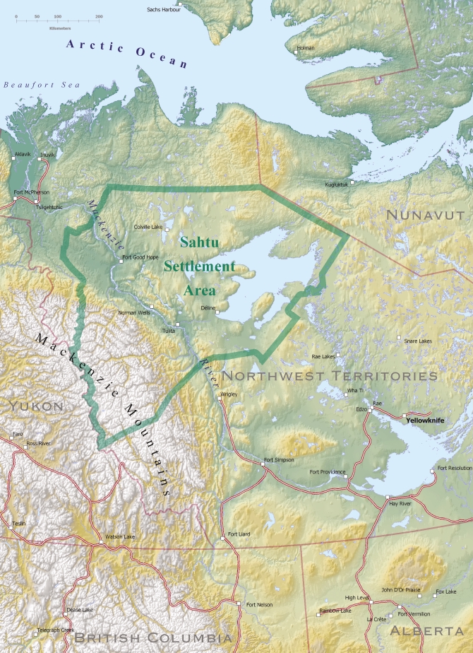
The Sahtu Region is a place rich in cultural heritage, breathtaking landscapes and natural resources. The maps in this atlas help reveal much of its wonder. There are recent maps of the Sahtu that represent ongoing scientific research, specializing in natural history, including climate, ecology, wildlife and resource distribution. Other maps show the Region’s modern infrastructure: its roads, seismic lines and pipelines. Even the boundary map, a patchwork of political and property boundaries defining Aboriginal, Crown, and Territorial jurisdictions is relatively new, created with the signing of the Sahtu Dene and Métis Comprehensive Land Claim Agreement in 1993.
These maps are in contrast to the traditional mapping of the original inhabitants of this land, the Dene. A fine mesh of trails over centuries of use traces a relationship with a territory that once knew no boundaries. This map shows the land to be animated by the Dene. They travel across the land. They know it, they name it. In the words of Dene researcher Phoebe Nahanni, “We have our own place names for all our camps, for the lakes, the rivers, the mountains – indicating that we know the topography of our land intimately” (from Watkins, 1977).
For the Dene of the Sahtu, the land is mapped in words. The Dene place names spread across the landscape are linked to a multitude of ancient stories that bind the people to the land in a way that is more than purely functional. The land becomes a representation of Dene history and spirituality since time immemorial, and patterns of land use and travel identify what it means to be Dene. Knowledge and skills evolved over generations for survival in a harsh climate are linked to an ongoing sense of responsibility in taking care of the land.
Since the days of the fur trade, the Dene have shared this land with their Métis relatives and neighbours. The Dene and Métis continue to maintain land based subsistence practices, but land use and mapping are now influenced by new factors. The sinuous traditional trail system has been overlaid with rectilinear seismic lines and the straight lines of political jurisdictions. Recent maps reflect conflicting visions for development and conservation of natural resources.
Methods of map making have also changed. The maps in this atlas are the product of sophisticated Geographic Information System technology, providing colourful bird’s-eye views of the land. But to truly know the Sahtu we still must walk the land, ride the rivers, learn and tell the stories.
Over the past decade, the Sahtu has become renowned as a centre for Dene and Métis cultural revitalisation and research, for its internationally significant conservation areas, and as a zone of intensive petroleum and mineral exploration and development. In bringing together stories and maps, this book reveals the key challenge of the current period in the Sahtu – that of balancing pressures for development and modernization with the values of environmental conservation, and preserving the access of the Dene and Métis to their cultural heritage on the land.
“Good quality maps can be used in support of many diverse projects such as: documenting traditional knowledge, determining shared use areas and reconciling conflicts, supporting compensation claims, negotiating co-management agreements, determining environmental impacts of development, negotiating protection and benefits from development, administrating land use permits, providing baseline data for community planning and resource management, developing education curricula.” - from original Sahtu Atlas proposal, 2001
[ Sahtu Atlas Table of Contents ]
[ Next Section ]


 Phone: 867-374-4040
 Email: