Ɂehdzo Got’ı̨nę Gots’ę́ Nákedı
Sahtú Renewable Resources Board

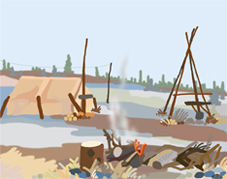
Mackenzie Valley Pipeline Proposal

In the 1960s, the Sahtu became the focus for major industrial development with the proposal of a Mackenzie Valley pipeline.

A flurry of seismic activity led to the discovery of major gas reserves at Prudhoe Bay, and subsequently beneath the North Slope of Alaska. The construction of a pipeline through Alaska was subject to delays due to environmental concerns and aboriginal claims. There was also opposition to transporting the fuel by tanker along the shores of the Pacific.

In 1967, feasibility studies were launched for a Canadian pipeline route. The pipeline would be 2,600 miles long, stretching from Alaska, across northern Yukon, then south through the Mackenzie Valley. The idea was given added impetus with the discovery of Canadian gas fields in the Beaufort Sea.

The federal government recognised that there could be legal complications in pursuing development, given that provisions of Treaty 11 remained unfulfilled. An initial offer including a financial package and promises of reserves was rejected by the Indian Brotherhood of the Northwest Territories.

In 1973, Chief Francois Paulette of the Fort Smith Chipewyan band filed a "caveat" claiming an interest in lands covering over one million square kilometres. Justice William Morrow decided the Dene case deserved to be heard. The Supreme Court reversed the decision upon appeal by the government, but the initial decision made it clear that aboriginal interests could no longer be ignored.

The Berger Inquiry from 1974-1977 investigated the "terms and conditions that should be imposed" in respect of the proposed pipeline. The Inquiry led to a moratorium on pipeline development in the Mackenzie Valley. It had a lasting impact on the people of the Sahtu in other respects. Research was initiated on aboriginal land use practices. This included the massive Dene Nation mapping project, and a variety of social and economic studies showing the significance of hunting and trapping for the communities. A layer of experienced Dene and Métis negotiators emerged in the Sahtu to lead the communities into the future.

pipeline

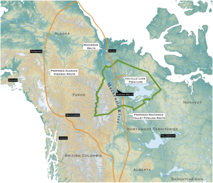
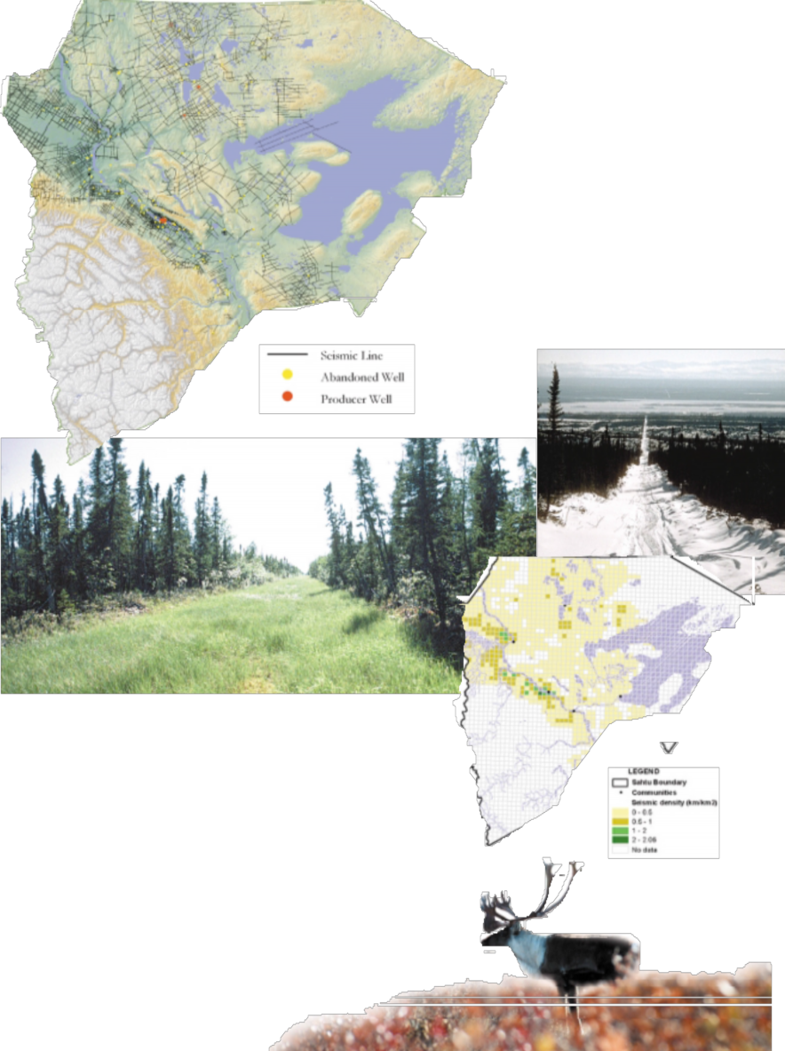
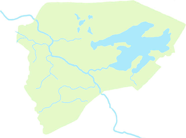
above - proposed Mackenzie Valley pipeline route and alternative Alaskan route
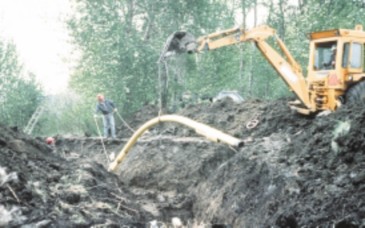
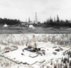
below - Laying the present-day Enbridge Pipeline and route map

Laying the present-day Enbridge Pipeline and route map

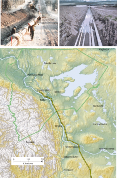
The Present Mackenzie Pipeline Route

The present Enbridge Pipeline extends approximately 870 kilometres (540 miles) between Norman Wells, Northwest Territories and Zama Alberta. From Zama, crude oil is transported through the pipeline facilities of others to Edmonton for refining.

As of July 2001, 26,000 barrels of sweet crude are shipped every day to Zama from Norman Wells along the Enbridgeowned pipeline which was completed in 1985. Because of the permafrost, it has to be cooled down to ensure that it does not melt the frozen earth and cause pipeline breaks.

the present Mackenzie pipeline route

[ Sahtu Atlas Table of Contents ]

[ Next Section ]

Caribou And Seismic Lines

Woodland "boreal" caribou are distinct from the woodland "mountain" caribou even though both are genetically the same subspecies. The key distinction being boreal caribou live in small, rather isolated groups and prefer areas of old growth conifer forest whereas the mountain caribou inhabit the plains and valleys of the Mackenzie Mountain region.

Research shows that boreal caribou are sensitive to the more intensive land use activities found in their habitat such as oil and gas exploration and extraction, particularly the cutting of seismic lines.

Extensive research in northeastern Alberta done by Alberta's Boreal Caribou Research Program (BCRP) have found that wolves utilize the seismic lines and therefore can travel much faster through the forest than through the dense bush, especially during the summer. It was found by monitoring radio-collared caribou that wolves using seismic lines were able to increase their efficiency at finding and killing caribou.

With this increased risk of predation, the radio-collared caribou were less likely to utilize habitat with a high density of seismic lines - more likely found in areas over 250 meters away from seismic lines. Therefore, areas within 250 meters of seismic are considered to be areas of habitat loss for caribou.

caribou and seismic lines

[ Sahtu Atlas Table of Contents ]

Oil and Gas

Petroleum exploration

With the Japanese bombing of Pearl Harbour in 1942, the United States Government planned to ensure a supply of fuel from Norman Wells via a refinery at Whitehorse to Alaska for military use.

Early oil rig in the Sahtu
Present-day rig near Colville Lake

The construction of the Canol pipeline for this purpose crossed 580 miles of rugged, mountainous country – much of it unmapped. Thousands of American troops, many of them blacks from the deep south who had never seen snow before, were sent north to assist in the construction of the Canol road and pipeline. Dene people were hired as guides – for many this was their first experience participating in a wage economy.

The first crude oil was pumped through the pipeline in 1944. Petroleum output rose from 266,882 barrels in 1943 to 1,229,310 barrels in 1944. But by the time the pipeline was completed, the Japanese threat had been countered and other cheaper fuel sources had been found. Production at Norman Wells fell to 353,117 barrels in 1944.

Rigworker-Drilling-Island-Gas-plant

top - Rigworker, near Colville Lake
middle - Drilling Island, Norman Wells
bottom - Gas plant, Norman Wells

There is one thing I would like to say about the oil in Åe Gohlini (Norman Wells). What was the name of the man who found that oil? It was our own father, Francis Nineye. When he found the oil, he took a sample of it, put it in a lard pail and brought it out into Tulít’a. That same summer, he had an accident and died.

Now the white people turn around and claim they found the oil. My dad was the first guy to find that oil. He was staying right where Åe Gohlini is now, and the Dene had about five or six log shacks. They were trapping and hunting there for a living. He took the sample of that oil in a lard kettle and brought it into Tulít’a. He gave it to Gene Gaudet, the Hudson's Bay Manager, and he sent it out on the boat, it had to be a boat, there was no planes then. We never heard of that oil again and we never got the lard kettle back. We never could do anything about it again. There is no record.

By John Blondin from Dehcho: "Mom, We've Been Discovered!" (Dene Cultural Institute, 1989)

Petroleum exploration

What are seismic lines?

Existing Wells And Seismic Lines

Most people in the Sahtu easily recognize the long, relatively straight cutlines that criss-cross much of the landscape. These lines are created during the early stages of oil and gas exploration to help “see” what is below the ground. Once a siesmic line is cleared, sophisticated equipment is laid out along it to measure acoustic shocks that are sent through the ground. By analysing the variations in the acoustic shocks as they travel through the ground, exploration companies can get an idea of what lies underground and if there is any indication of oil and/or gas.

[ Sahtu Atlas Table of Contents ]

[ Next Section ]