Ɂehdzo Got’ı̨nę Gots’ę́ Nákedı
Sahtú Renewable Resources Board

Sahtu Atlas Quick Menu

Background

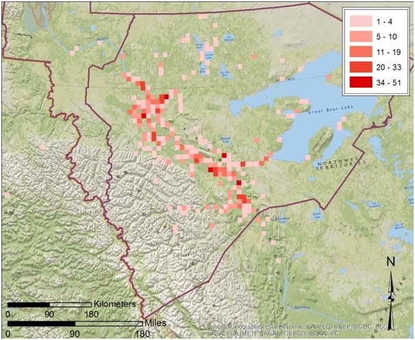
After more than a century of operations, Imperial Oil is planning the closure of the Norman Wells oilfields. This has raised questions in communities across the Sahtú region about the history of oil extraction at Norman Wells and its impacts on land, water, animals, and Dene and Métis ts’ı̨lı̨ (way of life). While Sahtú communities are rich with oral histories about Dene and Métis experiences of and engagements with petroleum development, they have questions about the historical motivations and actions of industry and government.

Over the course of 2020-21, these questions were communicated by community leaders and members to Ɂehdzo Got’ı̨nę Gots’ę́ Nákedı (Sahtú Renewable Resources Board – SRRB) staff dur­ing a series of study circles and meetings of the Nę K’ǝ Dene Ts’ı̨lı̨ – Living on the Land Forum. Together the SRRB and the Norman Wells, Tulı́t’a, and Fort Good Hope Ɂehdzo Got’ı̨nę (Renewable Resources Councils), with input from the Nę K’ǝ Dene Ts’ı̨lı̨ Forum, designed “A Century of Petroleum Extraction at Tłegǫ́hłı̨ (Norman Wells): Indigenous Knowledge for Indigenous Guardianship.”

This project has been granted an NWT Scientific Research Licence (#17015) and has received ethics approval from Aurora College (AC-REC #22-02).

Project description

The purpose of this project is to document the history and impacts of the oil industry at Norman Wells in order to support Sahtú Dene and Métis participation in closure and reclamation of the Norman Wells oilfields and strengthen present and future In­digenous roles in monitoring, stewardship, and decision-making.

Stories and knowledge gathered through oral histories, archival research, ground truthing (fieldwork), study circles, and in-person gatherings will be shared through a narrative history, story maps, a website, and short and feature-length films. In addition to expanding local understandings of the history of the Norman Wells oilfields, the knowledge generated through this project will support the development of community conservation plans in the five Sahtú communities. These plans, in turn, will provide a range of evidence for regulatory bodies (Sahtú Land and Water Board, Sahtú Land Use Planning Board, Mackenzie Valley Land and Water Board, and Mackenzie Environmental Impact Review Board) making decisions about the closure and reclamation of the Norman Wells oilfields.

Project objectives

  • Compile an archive of sources about the history and impacts of petroleum extraction at Norman Wells.
  • Record oral histories with a focus on Indigenous knowledge about cumulative impacts on land, water, animals, and Dene and Métis ts’ı̨lı̨.
  • “Ground truth” current evidence of cumulative impacts through boots on the ground observation by Nę K’ǝ́dı́ke – Keepers of the
  • Interpret current cumulative observations in light of historical knowledge through dialogue between Nę K’ǝ́dı́ke and elders.
  • Facilitate dialogue between Dene and Métis knowledge holders, Nę K’ǝ́dı́ke, youth, and collaborators about the impacts of petroleum extraction at Norman Wells.
  • Produce a community-informed and archival-based history of petrole­um extraction at Norman Wells to be used as documentation for: Sahtú communities participating in ongoing remediation, closure, and reclamation processes; regional decision-making related to conservation of homeland, wildlife, and way of life; and new resource development projects.
  • Contribute to community planning, proposal review, and input to the Sahtú Land and Water Board on closure and reclamation of the Norman Wells Proven Area, including design of a Nę K’ǝ́dı́ke program to monitor activities.
  • Contribute community presentations to the SRRB’s Public Listening Sessions (Hearings) on caribou.
  • In collaboration with the Gwich’in Tribal Council’s River Journeys team, train youth in video production and produce short videos about Indigenous knowledge and science related to CI of the Norman Wells petroleum extraction history, to be compiled as a feature documentary

Anticipated outcomes

Already this project is enhancing community knowledge of the history and impacts of the oil industry at Norman Wells through fieldwork, study circles, and in-person gatherings. It is also building connections and relationships between community members and collaborators, and between communities, government, and industry.

It is expected that this project will have significant impacts in empowering communities and supporting their involvement in closure and  reclamation. It will strengthen the evidence base for decision-making by co-management bodies in addressing objectives of the Sahtú Dene and Métis Land Claim Agreement with respect to wildlife conservation and maintenance of Dene and Métis ts’ı̨lı̨. It will help to build a new generation of knowledgeable, skilled, and responsible leadership by bringing together knowledge holders and youth through a variety of activities including study circles, fieldwork, and video projects. It will will expand awareness of Indigenous experiences of long-term cumulative impacts, and the benefits of meaningfully including Indigenous peoples and their values and knowledge in closure and reclamation planning.

Communities visit

The Petroleum Histories Project has received funding from the Ărramăt Project to visit each of the Sahtú communities this fall/winter. The purpose of these visits is to tell more people about the Petroleum Histories Project, answer questions and receive feedback about the project, and gather stories about the history and impacts of the Norman Wells oilfields. In this video, SRRB Research Director and Shúhtaot’ı̨nę Elder Leon Andrew talks about why this project is important and how you can participate. 

Team members, partners, and collaborators

Team members

  • Leon Andrew, Ɂehdzo Got’ı̨nę Gots’ę́ Nákedı (SRRB)
  • Deborah Simmons, Ɂehdzo Got’ı̨nę Gots’ę́ Nákedı (SRRB)
  • Catarina Owen, Ɂehdzo Got’ı̨nę Gots’ę́ Nákedı (SRRB)
  • Melanie Harding, Ɂehdzo Got’ı̨nę Gots’ę́ Nákedı (SRRB)
  • Jonathan Yakeleya, Ɂehdzo Got’ı̨nę Gots’ę́ Nákedı (SRRB)
  • Lisa McDonald, Norman Wells Ɂehdzo Got’ı̨nę (Renewable Resources Council)
  • Anne Marie Jackson
  • Jess Dunkin
  • Gillian Donald, Applied Ecology
  • Petra Dolata, University of Calgary

Partners and collaborators

  • Fort Good Hope Ɂehdzo Got’ı̨nę (Renewable Resources Council)
  • GNWT Department of Environment and Natural Resources
  • Gwich’in Tribal Council, Department of Cultural Heritage
  • Memorial University
  • NAIT
  • Nę K’ǝ Dene Ts’ı̨lı̨ - Living on the Land Forum
  • Norman Wells Ɂehdzo Got’ı̨nę (Renewable Resources Council)
  • Ɂehdzo Got’ı̨nę Gots’ę́ Nákedı (Sahtú Renewable Resources Board)
  • Tulı́t’a Ɂehdzo Got’ı̨nę (Renewable Resources Council)
  • University of Calgary

Funders

This project is funded by grants from GNWT Cumulative Impacts Monitoring Program (CIMP), GNWT Environment and Natural Resources, GNWT Industry Tourism and Investment, NWT Species Conservation and Recovery Fund (SCARF), Social Sciences and Humanities Research Council (SSHRC), Polar Knowledge Canada, and the Ărramăt Project.

Project Materials

pdf Project Description Flyer (1.25 MB) pdf (6.85 MB)

pdf Norman Wells In-person Gathering Report, March 2023. (6.85 MB)

  pdf 2022-2023 Annual Report (1.32 MB)

Petroleum Histories Project Team, "A Century of Petroleum Extraction at Tłegǫ́hłı̨ (Norman Wells)," ActiveHistory.ca, 5 December 2023.

Fall 2023 Study Circles Dates

Fall Study Circles Facebook Post


2014-2015 Wolverine Traditional Knowledge Study

 This project will gather and present Sahtú Dene and Métis traditional knowledge about the Species At Risk Act (SARA)-listed wolverine (western population, special concern) and its habitat. The project will include interviews and outreach in all five Sahtú communities (Tulita, Délı̨nę, Fort Good Hope, Colville Lake, and Norman Wells). Areas of increased shale oil prospecting south of the Mackenzie River will be of particular importance as habitat fragmentation and habitat alienation are of great concern in these areas. Wolverine threats which may be better understood include biological factors (low rate of increase and low density), harvest and predator control programs (wolf culling), and habitat threats (loss, alienation, fragmentation).

A draft report will serve as a spring-board for the education/outreach activities with students and Elders working together to spread awareness about wolverine as a species at risk component in Phase 2. Project outcomes will include a TK report on wolverine available for SAR processes, and an increased awareness of both wolverine and about the importance of species at risk processes in the NWT. This project therefore meets the expected result of helping to gather and conserve ATK and strengthening capacity in Aboriginal communities for SARA implementation.

Team Members

Funders

 Aboriginal Fund for Species At Risk (AFSAR)

Total Budget

 $48,129

 Research Licenses

 NWT Scientifc Research License - Aurora Research Institute 

Harvest Study Completion

What is the Sahtú Settlement Area Harvest Study?

The Sahtú Settlement Area Harvest Study or Sahtú Harvest Study (SHS) was a survey of Sahtú Dene and Métis hunters, trappers, and fishers that took place between 1998 and 2005 in all communities of the Sahtú Settlement Area (SSA). The Study recorded the number and location of wildlife harvested in the SSA.

Why was the Study done?

The SHS was a requirement of the Sahtú Dene and Métis Comprehensive Land Claim Agreement (SDMCLCA 1993). The objective of the Study was to estimate the total number of animals, fish, and birds harvested by Sahtú Dene and Métis for a period of five years. Based on the Sahtú Land Claim Terms of Reference (Sahtú Settlement Area Harvest Study, Schedule 1 to Chapter 13, 1993), estimates of harvested wildlife are intended for two main purposes:

  • To provide information on harvesting necessary for the effective management of fish and wildlife in this region by Sahtú Renewable Resources Board and Government, and
  • To determine the Minimum Needs Level of Sahtú Dene and Métis so that their harvesting traditions can be protected.

How was the Study Done?

The Study was coordinated by the Sahtú Renewable Resources Board in cooperation with Renewable Resources Councils (RRC) in Tulı́t’a, Norman Wells, Fort Good Hope, Colville Lake, and Délı̨nę. All Sahtú Dene and Métis harvesters who were at least 16 years old were asked to participate. Adult non-beneficiaries who harvested for Sahtú Dene-Métis families were also included. Harvesters were surveyed by Community Interviewers on a monthly basis between 1998 and 2003, then four times a year for two more years (2004-2005).

What are the findings?

Data resulting from the Study have been available for resource management and land use planning in a raw form since 2005. However, a 2012/13 assessment indicated that the Study was incomplete in that final results and analysis had not been calculated. In 2014, resources were found to do an important statistical analysis on the harvest totals, including measures of how reliable the results are. The proportional projection method was used to extend the Study results to the entire population of beneficiaries so that total estimated harvests and Minimum Needs Levels could be calculated. No analysis of locations or mapped data was done, nor was there any analysis of the age class and gender data that resulted from the Study. 

Harvest Study 2

Example map of results from the Sahtú Harvest Study. This map shows the locations of moose harvests in the Sahtú Settlement Area as reported to the study between 1998 and 2005. Harvest locations were recorded on 10 by 10 km grids. Here, each grid has been coloured to indicate the numbers of harvests. This map is based on draft numbers, and does not represent the total estimated harvest of Sahtú Dene and Métis. The information on this map is confidential; do not copy or distribute. Contact the Sahtú Renewable Resources Board for conditions of use.

A draft report of the Study results has been prepared. This report includes a detailed description of the survey and data analysis methods, as well as a series of tables presenting the analyzed data. For each community, there are tables of harvester response rates, recall periods, and total estimated harvests (by month, by year, and as five or seven year means). These results are also presented for the Sahtú Settlement Area as a whole (data combined for all communities). The number of harvesters harvesting each species is also reported for the whole SSA, but not by individual community.

What’s next?

In 2015/16 we initiated a series of workshops that provide an opportunity for community members to review the results from the Study and provide feedback on the Study and the data. The workshops are an important way of verifying and enriching the information collected by the survey and analyzed by the statisticians, and provide a meaningful local context and interpretation of the results. To date, workshops have been conducted in Délı̨nę Tulı́t’a and Rádelı̨kǫ́ (Fort Good Hope) and findings summarized and provided to the local RRCs. We are working to schedule similar workshops in Colville and Norman Wells in the near future.

With increasing levels of development in the Sahtú, the past Harvest Study can be seen as having established an important baseline, or ‘best estimate’ of what harvesting levels were like at the time it was conducted. However, because the survey stopped collecting information in 2005, there is a concern that the numbers are now becoming out of date and may not be a good indication of harvesting levels or patterns today. As a result, workshop participants are also being asked to discuss ideas for future harvest studies. The workshops will be a chance for people to talk about what they think worked well in the past harvest study, what didn’t work so well, what kind of information should be collected, and how a future study could be improved.

Team Members

Reports

  pdf Final Report of the Sahtú Harvest Study, 2021 (4.19 MB)

  pdf Summary of the Sahtú Harvest Study Final Report  2021 (263 KB)

Funders

Resources and Sustainable Development in the Artic (ReSDA), SRRB Wildlife Fund

Total Budget

$50,000

Sahtú Traditional Knowledge Guidelines Working Group

Traditional Knowledge Research Guidelines will be developed for the Sahtú Regions that are based on community experiences and perspectives, and industry and communities requests to have guidelines that identify best practices in TK research in the Sahtú Region in place as soon as possible. The guidelines will assist with understanding, and will be prepared in a way that is accessible for communities and at the same time useful for visiting researchers.

The project objectives are:

  1. To ensure community researchers assist with the content of the TK research guidelines.
  2. To discuss, verify and establish consensus with the Sahtú ERM Forum on the TK research guidelines.

Team Members

Funders

Wildlife Fund - Ɂehdzo Got’ı̨nę Gots’ę́ Nákedı, AANDC (Aboriginal Affairs and Nothern Development Canada)

Total Budget

$30,000

Dene Mapping

The Ɂehdzo Got’ı̨nę Gots’ę́ Nákedı wants a good idea of what computer-based mapping information exists and how to use it best.  Overall, our goals are:

Goal 1: to identify all the previously-recorded information on maps.
We’re asking ourselves: What maps can be found in the RRC offices, that have elders’ and hunters’ information on them?  Are there maps in offices in Yellowknife or elsewhere?  What projects happened recently or long ago, that included recording information on maps?

Goal 2: to bring this information together
We’re hoping to bring the maps, or paper or digital copies of them, to the SRRB office.

Goal 3: to make the information accessible to the communities to see and use.
We’re planning on creating a web-based map that RRCs can look at, once they enter a password to protect the special information.

Goal 4: to save the original research maps from decay.
In some cases, the maps are old and ripped and need to be cared for by a professional who will carefully preserve them for future generations.

There are two specific projects that are underway now to further these goals.

The first project, Dene Mapping Project Repatriation and Analysis: Understanding valued places at the intersection of caribou ecology and harvesting, includes work with the maps and computer files from the Dene Mapping Project, undertaken by the Dene Nation across the NWT in the 1970s and 1980s.  There is a trails map from this work which is being updated to modern computer standards, and other hunter/trapper wildlife observations on the maps which have remained hidden for decades will be brought to light and made available.  The old maps will be preserved by a specialist known as a conservator, and scanned for use in decision-making and research.  Once the information is updated and available, the SRRB will be working with the communities in meetings and workshops to understand how and when to use this information properly.

The second project is much broader in scope: Wildlife, Habitat and Harvesting: Responses to Exploration and Development in the Central Mackenzie Valley (CMV): State of Spatial Knowledge Component.  Overall, this project is focussed on aboriginal harvester responses to oil and gas exploration and development from traditional knowledge and scientific perspectives.  For the spatial state of knowledge component, the project’s goals are to identify and make accessible all the maps – computer and paper – that people have recorded information on and make sure that they remain confidential but useful for communities as appropriate. 

Through these and other projects, we are weaving together the information provided so generously over the years by many knowledgeable hunters, trappers, and other land-users, and hope that their knowledge and memories will last long into the future through the power of computerized mapping technology!

Team Members

Funders

Cumulative Impact Monitoring Program (NWT CIMP), SRRB Wildlife Fund, Education, Culture and Employment (ECE NWT) 

Total Budget

$97,000